Thursday, August 10, 2023

Announcement: Blog transition

Hello from Michigan Sea Grant (MISG) and the editorial staff behind this blog. We're grateful to all the previous MISG-affiliated fellows and interns who have contributed their insights and reflections to this blog since 2008. We're beginning to transition fellow and intern posts into MISG's online Newsroom. This site will remain active as an archive, and some previously published content will also be added to the Newsroom. We will also create a dedicated archive page on our website to make it easier to find fellow and intern posts in one place. Follow us on Facebook, Twitter, or Instagram to see when new posts go live!

If you have any questions about the content transition, please contact miseagrant@umich.edu


Tuesday, July 18, 2023

Join us for a day on the S/V Steelhead!

Editor's note: This post was jointly written by 2023 interns Hadley VandeVusse and Ava Tackabury. Photo credits go to Ava Tackabury.

Hi! My name is Hadley VandeVusse, and I am a rising senior at the University of Michigan. I am majoring in Earth and Environmental Sciences with a minor in Oceanography. After completing my formal education, I plan to attend graduate school and pursue a career as an environmental scientist with a focus on freshwater or marine ecosystems, working at either the federal or local level. Some of my research interests include population dynamics, acidification, ecosystem services, community structure, and microbial ecology. During the school year, I work under Gregory Dick as a research assistant in the microbiology lab at the University of Michigan. I primarily focus on researching Microcystis-dominated harmful algal blooms (HABs) in Lake Erie with the goal of furthering our understanding of bloom dynamics.

Hadley VandeVusse

This summer I was given the opportunity to work with the Michigan Department of Natural Resources (MDNR) on a research project studying Lake Trout population dynamics in Northern Lake Michigan. The study involves the use of acoustic telemetry to track the movement of the fish. It is necessary to gather more information about the movement ecology of Lake Trout for effective fisheries management. If we know what habitat fish like to occupy and how they traverse across areas it allows us to better implement harvest limits, refuge boundaries, and so much more. I am so lucky to be able to work on such an interesting project with an amazing team and in one of the most beautiful places in the country.
-----

Ava Tackabury

My name is Ava Tackabury and I am studying Earth & Environmental Sciences and Anthropology at the University of Michigan. I connected with Michigan Sea Grant earlier this year and am now stationed in Charlevoix, MI for a summer internship with the Michigan Department of Natural Resources (MDNR). Throughout my academic and personal journey so far, I have found that my interests lie where the natural and anthropogenic worlds become entangled—where species meet. It was this intrigue that drew me to my current research project, a multi-faceted approach to understanding the potential for future Lake Whitefish river spawning in Lake Michigan tributaries. Historically, Lake Whitefish used to travel upstream in Lake Michigan tributaries to lay their eggs each fall. Following mass habitat destruction from 19th-century logging and damming activity, however, there has been a dramatic Lake Whitefish population decline including the near loss of river spawners. Through our research, we seek a better understanding of the remaining river spawning habitat potential for Lake Whitefish so that future efforts can help to reestablish these historic spawning runs. Working with all of my project partners (MDNR, WDNR, The Nature Conservancy, the Sault Ste. Marie Tribe of Chippewa Indians, and the Little Traverse Bay Bands of Odawa Indians) has been a pleasure and I have quickly fallen in love with all that northern Michigan has to offer.

S/V STEELHEAD LAKEWIDE ASSESSMENT PLAN:

This summer, we have also been able to participate in several research projects currently being conducted at the Charlevoix Fisheries Research Station. A few weeks ago, we had the opportunity to accompany our boat crew on the S/V Steelhead, Michigan DNR's survey vessel in Charlevoix, during the annual Lakewide Assessment Plan (LWAP). Each year, the Steelhead studies adult yellow perch, lake whitefish, lake trout, Chinook salmon, and forage fish populations at a few Lake Michigan ports. The sampling year begins with the spring gill net survey in a collaborative assessment with other Lake Michigan agencies. Since 1997, the LWAP survey has provided MDNR with a comprehensive understanding of the status of adult Lake Michigan fish populations through a multispecies focus.

Click the links for more information on SV Steelhead Assessment Work or a video detailing SV Steelhead Bottom Gillnetting. Photo: Ava Tackabury


A DAY ON THE S/V STEELHEAD:

6:00 am:

We started the day bright and early. At the research station before heading to port, we gathered our gear— personal floatation devices (PFDs), bibs, coats, boots, and lined gloves. We then loaded all of the coolers with ice to prepare them for fish collection later on. Once everything was loaded and ready to go, we hopped in the truck excited for the day ahead. It was a short drive from the station to the port where the Steelhead awaited our arrival. We quickly transferred all of our gear and the coolers onto the boat, untied the lines, and headed through the Pine River channel into Lake Michigan.


8:00 am:

Our destination was just north of the Charlevoix port, where the crew had set gill nets a day prior, so we had a little time to relax before the grunt work began. During the ride, we enjoyed some yummy donuts under the sun. We traveled until we could see our first buoy (marked by a red flag) that indicated the start of a gill net before springing into action. 


9:00 am:

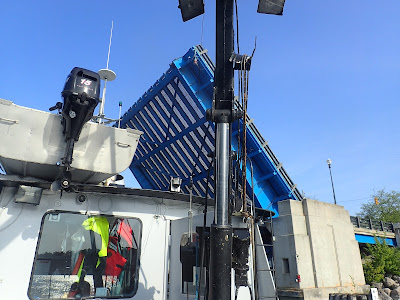
Once we reached the first buoy, the captain skillfully aligned the vessel with the gill net. A gill net is a wall of netting that hangs in the water column designed to allow fish to get only their head through the netting, but not their body. Using the lift machinery in the hull of the boat, we were able to pull in the gill net catch for sample collection. As the nets were rolled up into the vessel, we had to work quickly alongside the crew to untangle the large adult fish from the net.

Hadley: “Just when you thought you had them untangled from the nets, they would decide to wiggle around and you were back to ground zero again.”

Suckers, Lake Trout, and Lake Whitefish made up the majority of our catch (though we did manage to score one Burbot). We placed the fish in designated bins correlated with the specific mesh size and net depth at which they were caught. The crew said that the amount of fish we caught was a typical light catch, but the fact we pulled up that many in one day still astounded us.


12:00 pm:

Once we finished pulling all the gill nets, set the day prior, we moved the fish to the stern, loaded them into coolers, and put them on ice. Then, we brought the fish coolers into the wet lab where we “worked-up” the fish, taking various measurements and samples to be sent to the labs for later analysis. We took size measurements, coded wire tagged snouts, stomachs, otoliths, and maxillaries for all the fish, depending on the species and algorithm count requirements per species. To ensure the fish were not completely wasted after being sampled, we filleted and bagged the fish to give to the local community. Fresh Lake Trout is even more delicious when it benefits the scientific world.


3:00 pm:

After taking all of the required fish samples, we ended the day cleaning everything. All coolers, mats, counters, scales, and floors were scrubbed and hosed down. We also cleaned out the whole gill net lift room in the hull of the vessel as we pulled up a lot of zebra and quagga mussels that made quite a mess. Finally, after all the cleaning was complete and a quick snack break, it was time to cap off the day. Tiredly, we unloaded all the equipment off the boat and headed home, both of us satisfied with our work from the day.


Tuesday, June 27, 2023

Tracking Didymo with Rae Mckechnie

Hello! My name is Raven (Rae) Mckechnie and I am currently a double major at Lake Superior State University (LSSU). I am majoring in Animal Biology (Animal Health concentration) and Marketing with an E-Marketing certification. After graduation, I plan on continuing my education by attending graduate school. I am interested in a career that combines my passions for aquatic research, animal rehabilitation, and conservation and management of freshwater ecosystems. Last summer, I had the privilege to work for my tribe’s environmental department with the Sault Tribe of Chippewa Indians, where I was able to learn about invasive species management and removal while assisting on clearing efforts of active dangerous invasive plants. I am also continuing to strengthen my knowledge about aquatic research through my current employment at Lake Superior State University’s Center for Freshwater Research and Education. It is here that I am fortunate to be able to conduct my senior research with my mentor Dr. Ashley Moerke on Didymosphenia geminata (hereafter, Didymo) through the Center for Freshwater Research and Education as well where I can tie in my previous experience with invasive species and their effect on the ecosystem and fisheries industry into my research and overarching career goals. 

Didymo is an invasive algae that has been detected in the St. Marys River since 2015. Didymo is a threat to the environment because the dense mats that it forms alter habitat availability and light penetration and thus biodiversity and lead to a decrease in available food sources for fish. These dense mats can also cause economic issues impacting the fishing industry by their stalk material getting caught and ruining fishing lures and boat motors. 

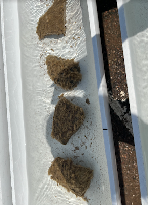
A clump of Didymo prepared for an experiment. Photo: Rae Mckechnie

There is no current method available for management of Didymo. The main method of control against this invasive species is through prevention of the continued spread of Didymo. This species of diatom can be spread through contaminated water and fishing equipment and boats that carry microscopic Didymo cells to other water bodies if unwashed. Since the main method of control is stopping its spread, the importance of being able to map and detect this invasive species prevalence early on is ever-pressing.

The basis of my senior research project is to determine the threshold level and sensitivity of environmental DNA (eDNA) testing for Didymo detection in Michigan waters. Since the sampling of Didymo with eDNA is a novel practice, there aren’t any established guidelines available. My project began by using eDNA methods established by a previous study (Cary et al. 2014). However, existing methods do not establish how the likelihood of detection of Didymo using eDNA would vary depending on the extent of Didymo populations, or the distance from the source of Didymo. The goal of my study is to understand, in a controlled environment, how eDNA “signals” differ under different distances and population sizes to enhance the interpretation of eDNA data. This is accomplished by sampling several sites spaced downstream from the main rapids in St. Marys River, a known Didymo infestation site, to determine the ability of the eDNA technology to detect Didymo at varying distances from a known positive source.

Collecting water samples in the St. Marys River. Photo: Rae Mckechnie


Nicknamed "gumby suits," orange immersion suits keep researchers safe and warm during shipboard sampling runs. Photo: Rae Mckechnie


Sample bottled up and ready to take to the lab. Photo: Rae Mckechnie


Didymo cells under the microscope. Photo: Rae Mckechnie

This summer I am also testing the effect of Didymo abundance on eDNA sample concentrations by utilizing a stream simulation system (outdoor experimental stream lab) and differing concentrations of positive samples of Didymo. This will help me understand if eDNA results are sensitive to changes in Didymo abundance and what is the threshold at which we can detect Didymo using eDNA. By researching the effect of the variables of eDNA samples, sampling guidelines can be formulated to better determine the concentration and source of Didymo in the St. Marys River and other tributaries. This information can then further be used to map positive Didymo samples in GIS software to map where it has been found and the resulting concentrations. Thus, helping aid in prevention of the spread, by knowing where Didymo is, we can more effectively work towards stopping its spread.

Didymo clumps resting in experimental stream lab channels. Photo: Rae Mckechnie 


Water flows through each stream channel for collection and analysis. Photo: Rae Mckechnie


Clumps of Didymo ready to do their part for science. Photo: Rae Mckechnie


-----  

Works Cited:

Cary, S. C., Coyne, K. J., Rueckert, A., Wood, S. A., Kelly, S., Gemmill, C. E. C., Vieglais, C., & Hicks, B. J. (2014). Development and validation of a quantitative PCR assay for the early detection and monitoring of the invasive diatom Didymosphenia Geminata. Harmful Algae, 36, 63–70. https://doi.org/10.1016/j.hal.2014.04.003

Friday, October 14, 2022

Can audio attract rails to habitat? A fieldwork reflection

By Dustin Brewer, Graduate Student Fellow

Dustin Brewer, wearing a hat and jacket, standing in front of a canoe on the waters of a foggy marsh

Can rails, a group of marsh birds, be attracted to appropriate Great Lakes coastal wetland habitat during spring migration by speakers that are broadcasting rail calls? That is the research question that I’ve been focusing on as a MISG Graduate Research Fellow. Now that the 2022 field season is over, I’m preparing to do my best to answer this question by analyzing data that I’ve collected in the field.
When I don’t tell myself to slow down, often I find myself moving forward to the next goal and forgetting what got me to where I am. For example, I might become laser-focused on completing steps needed to publish a scientific article after I’ve done the hard work of designing an experiment and collecting data. However, I’ve decided to take the time to reflect upon some initial field experiences that led to my current point of this research project. It has been an adventure!

My goal was to get audio playback equipment set up in the marsh before the rails were migrating north this spring. That way, the nightly audio playback would be ready for them when they arrived from the south during their nocturnal migration. So, that meant that I had to get myself and the equipment out into the icy marsh in March (which I thought of as "marsh madness!").

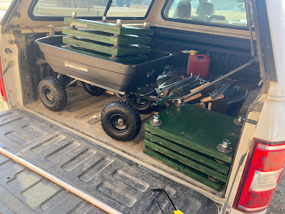
Luckily, my dad offered his skills and designed a platform system for the audio gear which could easily be assembled and disassembled:

A black cart sits in the back of a truck full of tools for marsh fieldwork

So, I was able to cut my way through the ice in a canoe and then assemble the platform for the audio gear in the marsh. Here is what an assembled platform, in the marsh, looks like:

A small green platform on metal legs sits among snow and ice in a wintery marsh

I got some of these platforms set up on March 17, well before I expected the first rails to arrive. This allowed me to test them out and to make sure that the ice wouldn’t shift and break the platforms, etc. I also expected that there could be spring flooding. However, I didn’t expect that the flooding would be as extreme as it was! This is what I saw on March 25 when I was trying to access one of my field sites:

A road flooded with water and ice, blocking a vehicle's access to surrounding marshlands

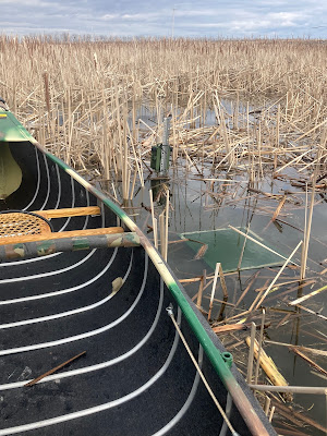
So, for the day, I didn’t access that site. I drove to a nearby site and went out into the marsh and set up some more platforms as well as a couple autonomous recording units (ARUs). My plan was that by having these recording devices deployed, I’d be able to better pinpoint when the rails arrived. When I came back the next week, I was shocked to see that the already-high water had risen another 2 feet! As you can see in this picture, my platforms were submerged and my ARUs narrowly avoided inundation.

A small green platform sits just below the water, visible next to a green canoe on the surface of a marsh

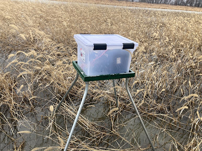
For me, this was an important lesson about how dynamic wetlands are. Water levels can change fast. And year-to-year conditions are often different, which could be one reason that rails might need to pay attention to the calls of other rails when trying to find appropriate habitat (which there isn’t much of anymore) in a given spring. With my understanding of water level fluctuations better established, and some new sites chosen, I set up my audio playback gear on the platforms and (I think) succeeded at getting the calls going before the rails began arriving. Here is a playback station with the speaker, timer, and battery in a secure plastic tote:

A small green platform stands in a marsh with a clear plastic tote on top of it, which is full of recording and broadcasting equipment

For the rest of the field season, everything was more or less "smooth railing." Every week I arrived to my study sites before sunrise and then got to spend a morning with the birds. I hope that my time in the field will help determine if more rails occurred near the audio playback stations compared to sites where nightly audio playback didn’t occur. If so, that could indicate that audio playback might be a helpful tool for guiding rails to appropriate habitat. I look forward to finding out! 

If you are interested in learning more about this research, and don’t want to wait for the scientific article that I’m working on, you can check out this story by Interlochen Public Radio: Thin As A Rail | Interlochen Public Radio.

Thursday, July 21, 2022

Adventures in Thunder Bay National Marine Sanctuary

By Cassidy Beach, Thunder Bay National Marine Sanctuary Intern (learn more about Michigan Sea Grant's summer internship program)

This summer I began my internship with the Thunder Bay National Marine Sanctuary (TBNMS), a partner of Michigan Sea Grant. The sanctuary is located in northwestern Lake Huron and aims to protect a nationally significant collection of nearly 100 historic shipwrecks in Lake Huron. Through research, education, and community involvement, the sanctuary works to ensure future generations can enjoy these underwater treasures. TBNMS also facilitates other sciences to study climate change, invasive species, lake biology, geology and water quality.

Map of Thunder Bay National Marine Sanctuary and Shipwrecks. Credit: TBNMS

Over the past few years I have really gotten to know the wonderful staff at the sanctuary. Two summers ago, I received my Open Water Dive certification with Stephanie Gandulla, who is now my research mentor here. She welcomed me like family into the sanctuary’s crew and now I get to play an important role here. Stephanie, the Great Lakes Environmental Research Laboratory (GLERL) and I are working on the first ever acidification research in the Great Lakes! When I heard about the importance of this project, I knew I wanted to be a part of it. What makes this internship even more special is that we are researching and teaching the public about a very pressing topic right in my hometown!

Acidification has been known to occur in the ocean and now we are beginning to research it in the Great Lakes. The process begins with an excess of carbon dioxide in Earth’s atmosphere from burning fossil fuels and large scale forest fires mainly. Over time, carbon dioxide is absorbed by oceans and lakes. It reacts with water to create carbonic acid which is known to be harmful in these ecosystems. It can promote the growth of harmful algal blooms which oftentimes block oxygen and sunlight from reaching deeper waters. Organisms below need these sources of nutrients to survive. Acidification can make it difficult for fish to grow, reproduce and metabolize. Carbonic acid also eats away at shells and makes calcium carbonate less available to organisms that need it to build shells and skeletons. This means they become thinner and more brittle. This is clearly an issue happening around all of us! An important thing to know is that you can make a difference by advocating for renewable energy sources, promoting public transportation and carpool options, shopping locally and many other things! If you're interested in learning about more ways to combat climate change and ocean/freshwater acidification feel free to contact me at cbeachce@umich.edu!

This topic is very important to all of us here at TBNMS so we were ecstatic to start this project. Typically, we go on the research vessel every week to collect water samples. The dive team at TBNMS is taking samples at depth and I am in charge of sampling the surface waters. To do so, I am using a peristaltic pump to squeeze bubbles out of the water and an instrument called a YSI (Yellow Springs Instruments- digital sampling instrument) to collect data on temperature, depth and salinity of the water. Three samples are collected at the surface each time: one to measure total carbon, one to measure dissolved organic carbon and one to measure total alkalinity, which is the water’s capacity to resist acidic changes in pH. After we finish the sampling process we send them to GLERL [NOAA's Great Lakes Environmental Research Laboratory] in Ann Arbor for Dr. Reagan Errera to analyze for important water chemistry indicators.

Stephanie (left) and Cassidy (right) collecting water samples on a research vessel. Credit: NOAA


RV Storm docked in front of the offices of Thunder Bay National Marine Sanctuary. Credit: NOAA

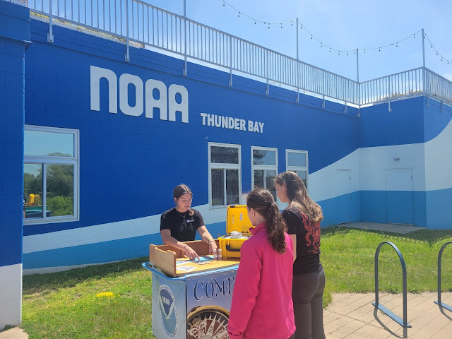
This project really has been a great experience thus far. We are really trying to engage our community in the science behind this project. We have a station at the TBNMS visitor center set up for me to talk to the public about freshwater acidification and how it works. We will create a social media campaign and a one pager for more people to join in and learn about it as well! Overall, this project has been very rewarding and it has only been a month since I’ve started! I have experienced so many new things: working on a glass bottom boat, educating tourists and locals about climate change, meeting Viking Cruise passengers, participating in a news interview and most importantly working with scientists!

Cassidy educating visitors about freshwater acidification. Credit: Caleb O'brien


Thursday, September 16, 2021

Making changes: A new vision for Assateague State Park

By Kate Vogel, Coastal Management Fellow

In my fellowship experience with the Maryland Department of Natural Resources, I’ve truly learned the importance of collaboration. Whether I am working within different units in the DNR, or partnering with community organizations, I’ve learned that innovative partnerships are going to be the epitome of climate change adaptation and resilience. The focus of my work is to write climate change adaptation and resilience plans for three state lands: Assateague State Park, Browns Branch Wildlife Management Area, and Pocomoke State Forest. My project stemmed from maps created through a partnership with the Eastern Shore Regional GIS Cooperative at Salisbury University, which showed areas on these state lands that were vulnerable to climate change, or ranked highly in ecological value. Using these maps allowed me to guide conversations with land managers to identify problem areas and adaptation opportunities on site. Assateague State Park, despite being the smallest of the three, has proven to have a wide variety of areas where climate change is a concern.

Climate vulnerability map for Assateague. Climate vulnerability is on the left, and ecological value is on the right, with darker colors representing higher scores.

As I continued my research and dialogue with partners on climate change threats and opportunities for adaptation, I decided to break down climate threats by their impacts: infrastructure, natural resources, human resources, cultural resources, and recreation. Each of the sites that I am working on is very different. Browns Branch Wildlife Management Area has historically been managed as an agricultural area with a small stream running through the site. Pocomoke State Forest is 18,000 acres of non-contiguous forest lands across the eastern shore of Maryland, offering many recreational opportunities, but not many recreational facilities. Assateague on the other hand, is a two mile stretch of dunes, beaches, and campsites on the Atlantic Ocean. It receives over 700,000 visitors every year and is host to many amenities including the beach itself, a restaurant, bike paths, public restrooms, changing areas, a nature center, ranger station, and boat launches. This makes Assateague unique in terms of recreational and infrastructure challenges -- Assateague’s facilities need to support large numbers of visitors while being resilient to worsening storms, increasing hurricanes, changing wind patterns, and increasing temperatures.

Map of park regions.

I’m not a coastal engineer, nor am I a geologist who knows how Assateague’s dunes will migrate over time. The more we analyzed maps and climate threats, we realized that campsites would be underwater or under sand, and that buildings would only continue to break down as they faced the brunt of intense winds and flooding. I was able to suggest moving roads and using mobile, elevated buildings in my site plan, but without tangible graphics and a site-based analysis of feasibility, I realized I did not have much evidence for why or how we should redesign the buildings and roads to be climate resilient, especially when many of the roads were recently redesigned in 2018. I was the new girl in the office who was saying “we should change the way you have historically done everything, even though I’ve never done it before… even though repairs were just made a few years ago.”

Sand covering the walkway at Assateague State Park. Photo: Kate Vogel 

So I decided to bring solutions with the help of my mentor. She suggested we could work with the University of Maryland (UMD) Architectural Studio. They have a program, the Partnership for Action Learning in Sustainability (PALS), which connects students with real life projects and aims to find innovative ways to address climate change. We were able to get matched with two architectural studio classes: one to create designs for Assateague State Park’s ranger and camper registration building, which is slated to be reconstructed soon, and the other to redesign the concession stands and day use area, which also need updating. The first studio is taking place this summer, and has already been very eye opening, not only for me as it relates to my project, but for leaders in DNR Parks and Recreation, and Engineering and Construction. Good decisions take time, and that includes formulating plans to create innovative designs and determine which projects should be prioritized first over others. We were lucky in that right before the students visited Assateague, we had actually received the first draft of the state contractors’ designs for buildings. In very traditional drawings, the buildings were elevated and rectangular in addition to appearing more modern than the current building. They were exciting to see - and the students took the drawings even further.

The ranger station at Assateague State Park. 

In presentations that occurred once every 1.5 weeks, the four UMD students presented their diagrams to a multidisciplinary team of UMD professors, MD DNR staff from Engineering and Construction and Chesapeake and Coastal Services, and JRS architects. Our climate change mission at Assateague State Park is to “to conserve and foster an appreciation of the natural resources of Assateague State Park and to continue to provide substantial recreational opportunities for as long as possible in a sustainable manner.” The students rose to the challenge of making this a reality. Their ideas conceptualized dune migration over time, and they showed how it would be possible to change campground layouts without compromising campsite availability, while allowing dunes to migrate. They proposed new solutions for increasing shading in the day use area, an increasing concern of park staff as temperatures increase and heat stress becomes more common. Students identified opportunities for educational landscapes, where visitors could learn about the history of the land, dune processes, biodiversity, and more. Building designs included passive ways to harness wind and solar energy, while creating an engaging, welcoming, and natural landscape for visitors. Creative elevation designs showcased opportunities for reducing impervious surfaces and increasing ADA accessibility, so that the building will be inclusive for all guests and utilize techniques to reduce flooding on site. Building designs referenced indigenous architecture and prioritized connectivity and flow among office spaces and public spaces.

Sample graphic from Yan Konon, a student with the University of Maryland Architecture Design Studio

Credit: University of Maryland Partnership for Action Learning in Sustainability


The students were able to build off of the coastal program’s climate change research by showing that it is possible to be innovative and still create feasible construction designs that will withstand a changing climate. Coming to our design teams empty-handed, and not as an engineer or architect, would have made me ill-prepared for explaining how our climate change adaptation vision could be implemented. After listening in on calls, park leadership and members of engineering and construction said the designs were “surprising” and “inspired ways for E & C to get more creative.” We were also told that an amendment to the design timeframe may allow for student designs to be considered by the professional JRS architects, and might allow for the inclusion of an educational landscape for visitor engagement, which was not originally in the design plan.

Good things take time. Good things also are made possible by collaboration and resource sharing. Climate change is going to require that we think outside of typical design requirements and recognize the need for adaptable designs. As we analyze project designs to respond to climate change, we should think about engaging new and different partners and remember that there is so much more room for creativity, connectivity, and education in our lives, as long as we embrace it.

Wednesday, August 18, 2021

Sampling Lake St. Clair's Bioswales with Cynthia Gutierrez Navarro

By Cynthia Gutierrez Navarro

My name is Cynthia Gutierrez Navarro. I am the first (hopefully of many more) University of Detroit Mercy student to become a Michigan Sea Grant Intern.

My project evaluates levels of Fecal Indicator Bacteria (specifically E. coli and coliforms) with respect to invasive plant species in a network of bioswales at Lake St. Clair Metropark.

In 2013, Lake St. Clair underwent a 5-million-dollar green space renovation in order to create a network of 8 bioswales that would redirect stormwater runoff into Point Rosa marsh.

Bioswales are networks of green space infrastructure designed to mimic natural systems and redirect storm water runoff to Point Rosa Marsh at Lake St. Clair Metropark.

Collecting water samples and water chemistry data of bioswales-network at Lake St. Clair Metropark. Photo: Cynthia Gutierrez Navarro

Invasive plant species, Phragmites australis (Common Reed) and Hydrocharis morsus-ranae (European Frogbit) have overtaken the bioswales and marsh. We know from primary literature that invasive species can alter bacterial communities.

My research has shown that the bioswale network is failing to sustain fecal indicator bacteria levels at EPA limits for recreational water regardless of the presence or absence of invasive plants. All bioswales scored (statistically) at or above EPA limits for both E. coli and coliforms.

My project is in collaboration with Lake St. Clair Metropark and Wayne State University. One of the most enjoyable parts of my summer internship is the collaborative experience I’ve had with other researchers. 

Running into Brittany Bonnic-Khalil, lab manager at Wayne State University's HEART field station at Lake St. Clair. Photo: Cynthia Gutierrez Navarro

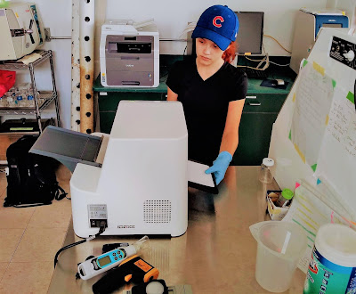
Analyzing IDEXX results after 24-hour incubation period. A yellow appearance in the Quanti-tray sleeve results positive for total coliforms in the sample. Photo: Cynthia Gutierrez Navarro

Using IDEXX sealer housed in WSU's HEART lab to quantify total coliforms and E. coli. Photo: Cynthia Gutierrez Navarro  


Wednesday, July 28, 2021

Adventures in electrofishing: A fish modeler gets a feel for the real world

 By Emily Morgan Liljestrand, @fishmodeler

Emily with a white sucker in her net. Photo: Emily Liljestrand

My girlfriend’s primary concern was for the safety of the fish.

My biggest worry was getting electrocuted.

We were discussing my plans the following weekend to assist a colleague on an electrofishing trip. Despite the intimidating and dangerous sounding name -- spoiler alert -- no fish were harmed and no humans were shocked! Both of us, it seems, were quite ignorant of what is actually involved in this common fisheries science technique.

As a political scientist, my partner had never even heard of electrofishing, and though I am a fisheries science PhD candidate at Michigan State University, I’m more of an “indoor” researcher. My dissertation project involves re-working stock assessment models of Lake Whitefish. But when my colleague, Josh Hoekwater, asked for my help with his research on resource competition between slimy sculpin and round goby, I jumped at the opportunity to get outside for once.

If Michigan can be approximated using one’s left hand, the Jordan River is approximately at the cuticle of the ring finger. After the 3-hour drive from Lansing, we parked near a bridge overcrossing the river. While I grabbed a hand net, Josh donned his “proton-pack” style backpack electrofishing unit.

Joshua Hoekwater, doing his best ghostbusters impersonation. Photo: Emily Liljestrand

The “backpack,” seen in the picture, is connected to a handheld electrofishing wand. When Josh pulled a trigger, the metal ring of the wand would emit a low frequency and nonlethal electric current to stun fish. Reclusive tiny species like the sculpin or goby, which hide under submerged detritus, would float to the surface. That’s when I came in. Net in hand, I would spot the disoriented individuals and scoop them up before the river could carry them downstream. Once we confirmed the fish identity, we could toss them back to their homes to recover and resume their mid-day activities.

Occasionally, when I splashed my hand into the water while the electrofishing unit was active, I could feel the gentle buzzing that the fish were experiencing. Far from the sensation of touching a power outlet, the feeling conjured mental images of eating pop rocks or sitting in a vibrating massage chair. And though Josh’s pack had a heavy, scary-looking industrial battery attached to the bottom, there was a safety mechanism such that if the unit even touched the water, the entire thing would disconnect, eliminating the possibility of electrocution. Ultimately both my and my girlfriend’s worries were unfounded!
A sculpin netted by the author. Note that the two pelvic fins identify it as a sculpin, and not a round goby. Photo: Emily Liljestrand

Though Josh and I identified about five of the endangered slimy sculpins that day, no invasive round goby made it into our net (there’s always the chance that one of the few individuals that got away from me may have been the latter). This was a great finding for the environment, but a bad day for Josh. He was hoping to find sections of the river that were only occupied by sculpins, areas only populated by goby, and regions where they coexist. Once he does so, his next step is to strategically place submerged cameras to monitor how they compete for space with the long term goal of better understanding the ecosystem and how to maintain our fisheries.

So, alas, the following Monday found Josh back at the drawing board, revisiting the maps and planning new exploratory outings. And I was back to my desk, my three monitors, and my air conditioning, combing through computer code. But I was happy for the reprieve in the “real world” of fisheries science. Sometimes looking too long at numbers on a screen can make a gal forget what those numbers represent, and I was grateful for the reminder.

Wednesday, July 21, 2021

An otter ate my homework: Updates from intern Rachel London

Meet Rachel London, one of Michigan Sea Grant's 2021 summer interns! Rachel is an undergraduate student at Michigan State University. This summer, she is working with the MSU Aquatic Animal Health Laboratory and Michigan Department of Natural Resources Fisheries Division to explore the potential causes of reported skin lesions in smallmouth bass. Here's an update about her project:

Skin lesion on a smallmouth bass. Photo: Rachel London

I recently traveled to Sault Ste. Marie to coordinate with the Sault Ste. Marie Tribe of Chippewa Indians. I learned how to boom shock [a method of using electricity to temporarily stun and collect fish] and found 7 "amazing" lesions on 7 different fish. I utilized the non-lethal sampling techniques that I have been piloting on all 7 fish. 

Boom shocking equipment on a sampling boat. Photo: Rachel London

Unfortunately, when we returned to the net pen the next morning, 5 of the fish were missing from what we believe to be an "otter attack." So, an otter literally ate my research. Fortunately, we still lethally analyzed the remaining 2 fish, and I am hoping to return to Sault Ste. Marie again within the next few weeks to find more fish.

Ready to scoop up a fish -- or fend off an otter. Photo: Rachel London


Tuesday, July 13, 2021

A Work in Progress: Reflections on Capitol Hill Ocean Week 2021 and Diversity, Equity, Inclusion, and Justice in the Ocean and Great Lakes Policy Sphere

By So-Jung Youn, Knauss Fellow, Policy and Constituent Affairs Division, NOAA National Ocean Service 

Note: This post was originally published on NOAA Sea Grant's Knauss blog and is republished here with the author's permission.

So-Jung Youn
Even after half a year of remote work, I still get nervous when logging onto a virtual meeting. Somehow, my internet always seems to cut out right before an important meeting or deadline. So, with a quick plea that my internet connection would remain stable, I clicked on the link for the Capitol Hill Ocean Week 2021 breakout session (Leading JEDI from Within) that I had spent weeks planning as part of my Knauss Fellowship. And...the internet held out! For a few minutes anyway. Then I lost all video input, but at least I could still hear the panelists. Such are the joys of attending a virtual conference.


Capitol Hill Ocean Week (CHOW), annually convened by the National Marine Sanctuary Foundation (NMSF), gathers people from around the U.S. and across sectors to engage in dialogue about how to sustain the health of our ocean and the Great Lakes. Since 2001, scientists, policymakers, scholars, businesses, and conservation leaders have attended CHOW to learn about current ocean and Great Lakes policy issues. For the past 2 years, CHOW has been a completely virtual event. 

The theme of CHOW 2021 was Justice, Equity, Diversity, and Inclusion: Sustaining our Ocean and Great Lakes. Over three days (June 8-10), attendees heard from diversity, equity, inclusion, and justice (DEIJ) advocates and leaders throughout the United States, U.S. territories, and Indigenous nations. While most speakers were optimistic about current efforts and future progress, the panels highlighted how, in a lot of ways, we are still at the beginnings of DEIJ in ocean and Great Lakes spaces. Many panelists highlighted the meaningful change that could occur if each attendee decided to intentionally do one thing differently as a result of the talks they heard at CHOW. Speakers also emphasized that DEIJ is ongoing, continual work that never ends; but we shouldn’t let perfection or the fear of falling short get in the way of making progress, however small. 

Another key theme was the importance of relationships in creating change and making a difference. Many speakers discussed the importance of mentorship and support in their own journeys. They urged attendees to find someone they could mentor and influence, and most importantly, stay with those people throughout their career (Thanks to Senator Cantwell for mentioning Sea Grant’s fellowships and the need to continue growing these opportunities!). 

One of the responsibilities of my Knauss Fellowship position was to help coordinate the National Ocean Service’s (NOS) participation during Capitol Hill Ocean Week. We decided to host a panel discussion on the progress NOAA has made toward DEIJ efforts and the work that still needs to be done. The panel was moderated by Nicole LeBoeuf, the Acting Assistant Administrator for NOS, and featured DEIJ advocates and leaders throughout NOAA. The panelists noted that while DEIJ is an organizational value of NOAA that is championed at all levels, there is still work to be done in keeping individuals engaged and making sure DEIJ efforts are visible and opportunities are available to all employees. 

I’ve struggled my entire life with whether, and how, to engage with DEIJ efforts. On one side, I know firsthand the importance of being a DEIJ advocate at the individual and institutional levels. I’ve been fortunate in my opportunities because of the people who took a chance on me and the people, past and present, who worked to realize their vision of a more inclusive and equitable society than the one they live in. On the other hand, as one CHOW speaker noted, “The biggest challenge is always fighting.” DEIJ work is exhausting. I’ve gone through periods where I’ve been very involved (Asian American and Korean American groups in college, DEI committees and initiatives during grad school), and then burned out, refusing to have any involvement whatsoever. The reality, however, is that as someone whose name and appearance are obviously non-white, I always have to be a DEIJ advocate, no matter how tired I am, regardless of whether I want to be an advocate or not. And, as exhausting as that work can be, listening to the speakers at CHOW renewed my energy for engaging in DEIJ work. 

So-Jung Youn and other executive board members of the Korean American Students Association (KASA) display posters about KASA's activities and events during an event welcoming new students to the College of William and Mary.

There’s something to be said for the strength and comfort you find in being surrounded by a community that’s passionate and dedicated to the same issues you care about. Listening to these speakers, I was inspired by their stories, dedication, and perseverance. These talks reminded me of why I wanted to go to graduate school and participate in the Knauss Fellowship: my interest in human connections to our natural resources and to each other. As so many speakers emphasized, relationships should be transformational, not transactional. In looking to increase DEIJ in our own spheres, it’s important to remember that we are all where we are now because of key people in our own pasts. So that’s the message I’m taking forward from CHOW 2021: DEIJ is always a work in progress, but there’s a wide community of support out there and each person, no matter where they are in their career, can make a difference in their own spheres of influence.